
 Italiano
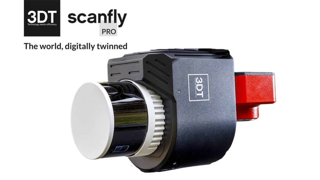

SmartProcessing Lidar
Your point clouds, at their best!
Key benefits
- Intuitive Graphical User Interface
- Efficient direct geo-referencing engine
- Point clouds exported with intensity and RGB data
- 2D maps, 3D preview and quality diagrams
- Full support to geographic reference systems
- Ground control points and strip alignment tool
- SLAM tool to increase accuracy in bad GNSS conditions
- Blurring tool for faces and license plates
Easy-to-use
A keystone of the easy-to-use philosophy of Scanfly, SmartProcessing Lidar features the 3D Target’s proprietary direct geo-referencing engine to empower the extraction of accurate point clouds from the best estimate of the trajectory and the synchronized Lidar data.
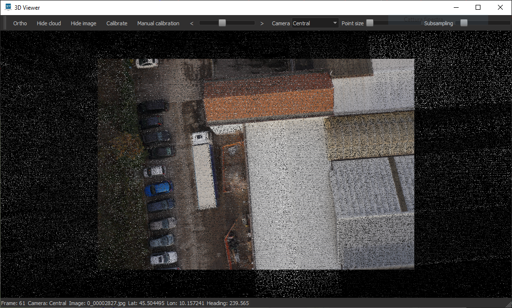
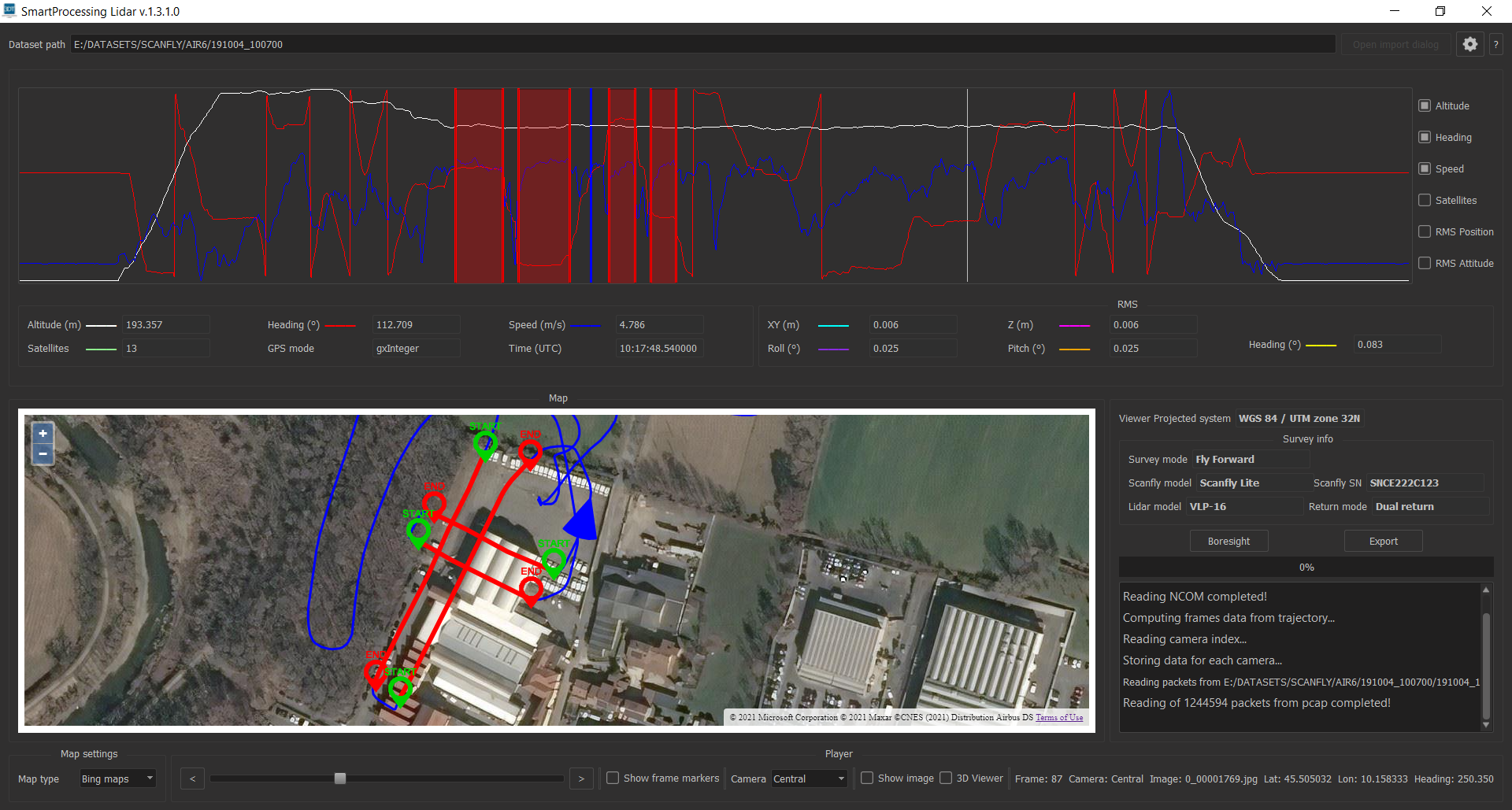
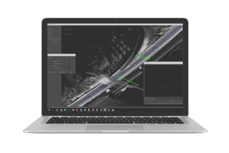
From the definition of the lines to be extracted to the export settings, the procedure requires just a few clicks, Quality check diagrams, 2D map overlays and a full 3D window are available to help the user in the process.
Intuitive tools are available to calibrate the sensors’ boresight parameters and to filter, optimize, and colorize the point clouds.
Overview
SmartProcessing Lidar runs under Windows OS and is necessary to post-process the data surveyed with Scanfly and selected third-party Lidar payloads.
The license is provided in the form of an activation file with detachable network seats.
The Core includes the basic functionalities; additional tools are available optionally.
With SmartProcessing Lidar, your point clouds will always be at their best, ready to be exported in your preferred third-party software for further analysis.
SmartProcessing Lidar Core
- Automatic import of raw Scanfly data
- Import of DJI Zenmuse L1 datasets
- Custom line selection
- Custom export settings
- 2D Viewer: maps and accuracy diagrams
- 3D Viewer: point clouds and image overlays
- Point cloud export in industry-standard formats
- Add RGB data to the point clouds
- Direct export for 3rd party software
- Full geographic reference frames support
- Custom geoids
Boresight calibration tools
- Support for the LiDAR intrinsic parameters
- LiDAR boresight calibration
- RGB imagers boresight calibration
- Easily store and retrieve parameters
GCP and Strip Alignment tool
- Line by line adjustment with strip alignment algorithms
- Increase the global accuracy using Ground Control Points.
SLAM tool
- Process your data from area without GNSS availability indoor
- Enhance the quality in difficult GNSS conditions outdoor
- Enabled for backpack and car surveys
- Dedicated environment-based presets
Full 360° panoramic camera support
- Full support to high-resolution panoramic imagers
- Masks editor to remove visible vehicle parts
- Coloured point cloud
- Exclusive ARS (Anti Rolling Shutter) algorithm
Blurring tool for faces and license plates
- Comply with privacy laws
- Automatically blur license plates from any vehicles
- Mask human faces found in the images


Related products
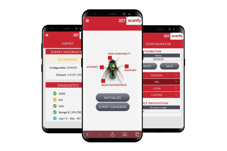
The Scanfly integrated application software at your fingertips.
Advanced mobile mapping data analysis tool.

Redefine mapping: anytime, anywhere with Scanfly PRO! THE MULTI-PLATFORM MAPPER

EVOlution - Map effortlessy with Scanfly EVO! THE MULTI-PLATFORM MAPPER

The dual lidar solution for 3D Lidar scanning. Perfect for Mobile Mapping applications. Recommended speed up to 100 Km/h.