
 Italiano
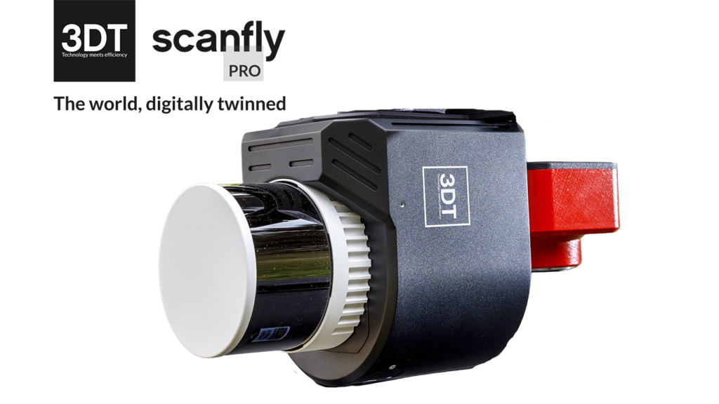
SmartSurvey
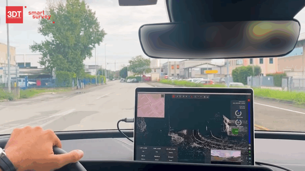
SmartSurvey is the desktop software to configure and control the data acquisition of Scanfly sensors in real-time, turning fieldwork into a safer and more efficient experience, with a smooth and intuitive interface.
Key benefits
- Monitor sensors and critical resources status
- Plan missions using KML import
- Configure parameters before data acquisition
- Real-time point cloud visualization and dynamic on-map position
- Verify camera view and field synchronization
- Analyze coverage, overlaps and missing segments
SmartSurvey
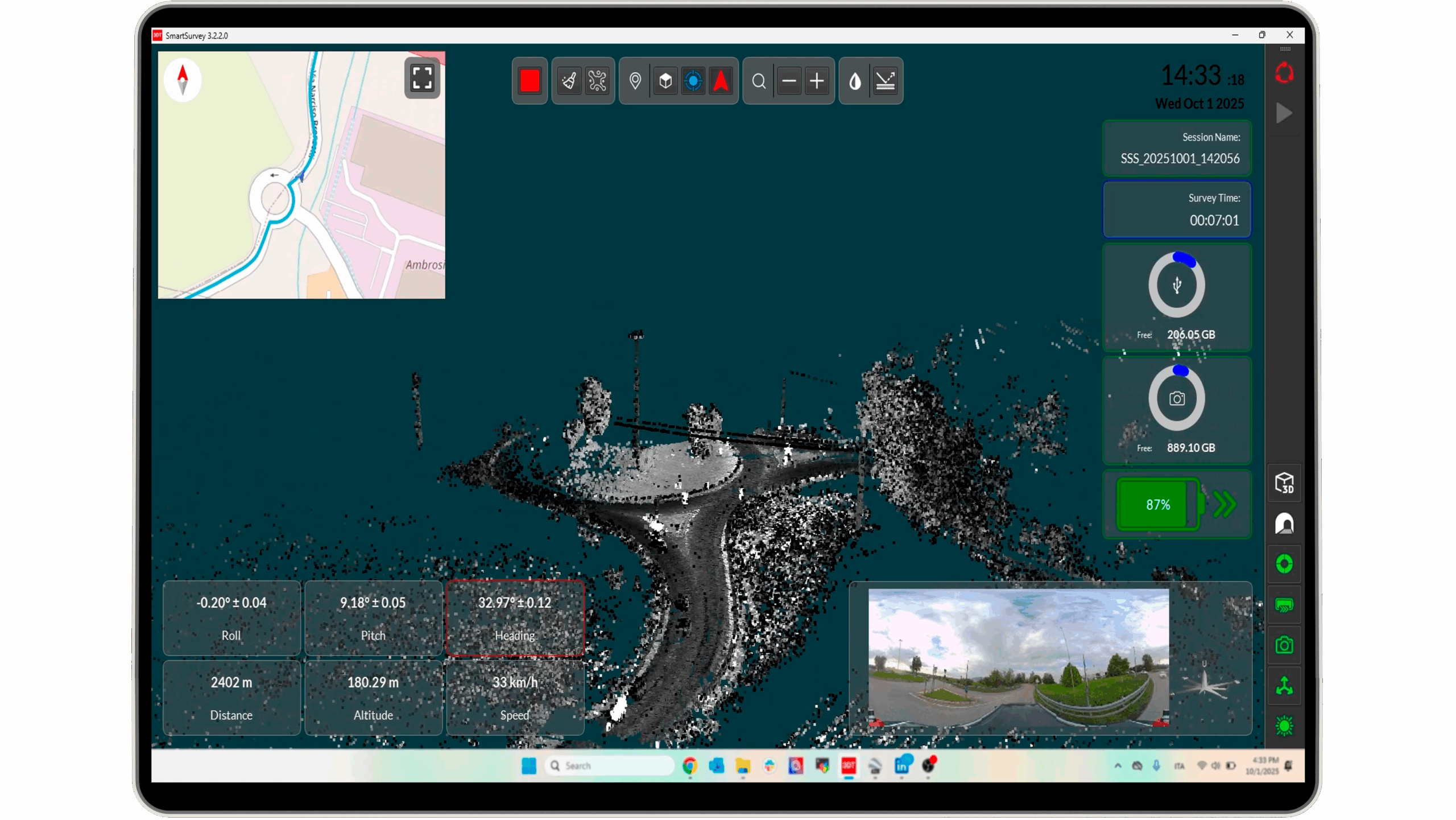
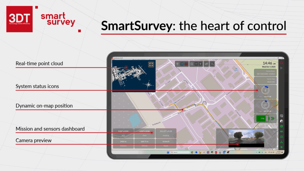
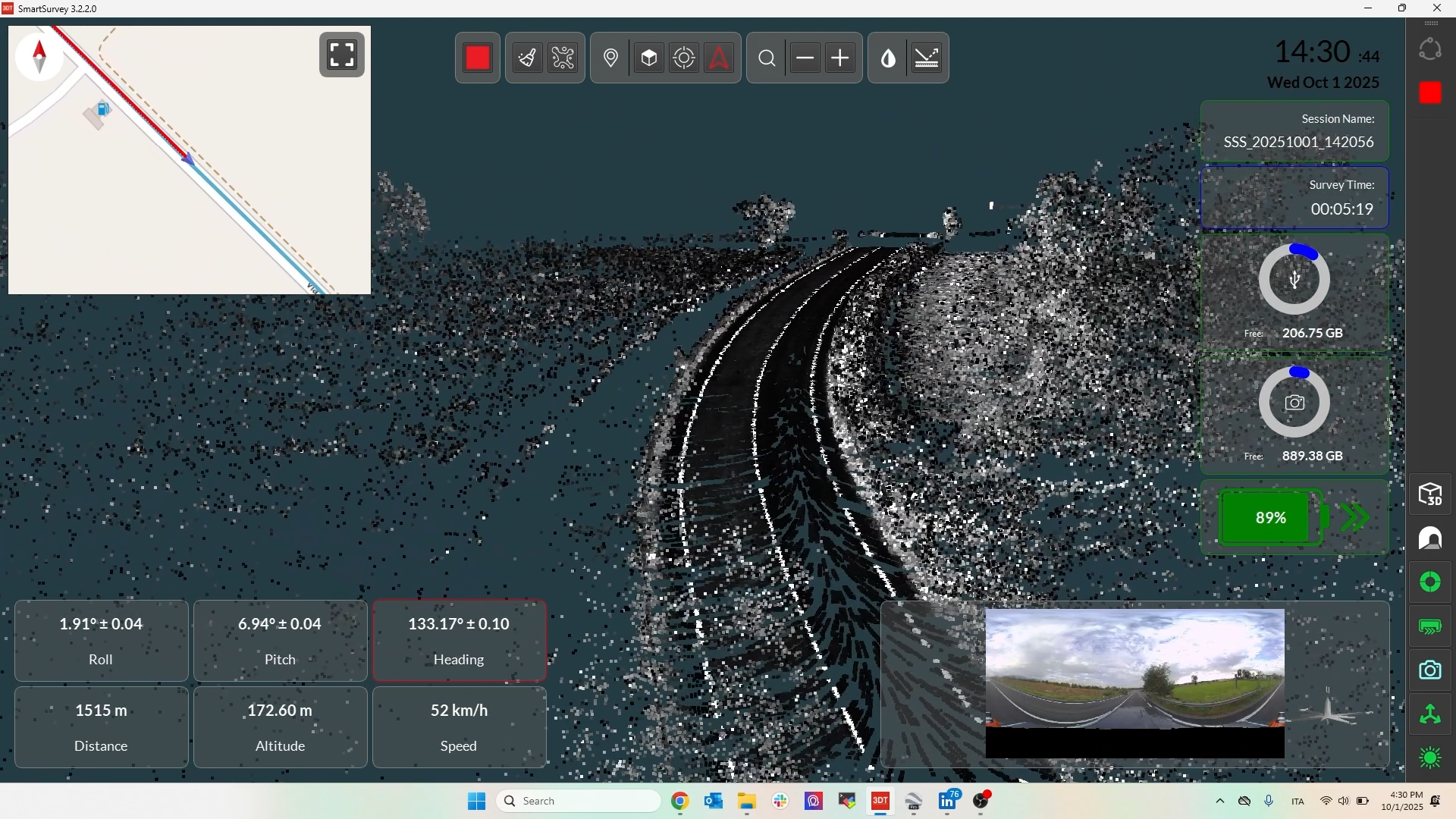
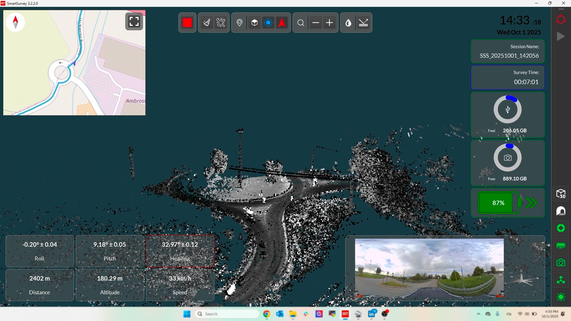
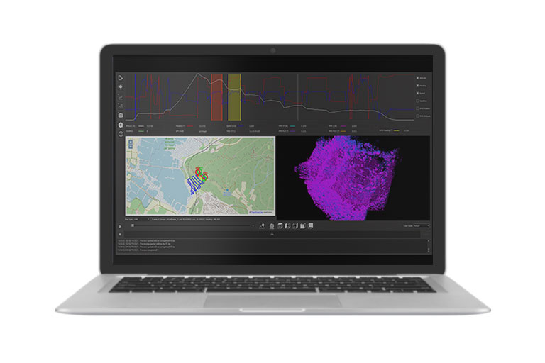
SmartSurvey brings simplicity and power into the operator’s hands, placing them at the center of every survey.The Sensor Health Dashboards provide full feedback on the status of resources such as battery and storage, as well as INS, LiDAR, and Camera, guiding the operator through every stage of the mission.
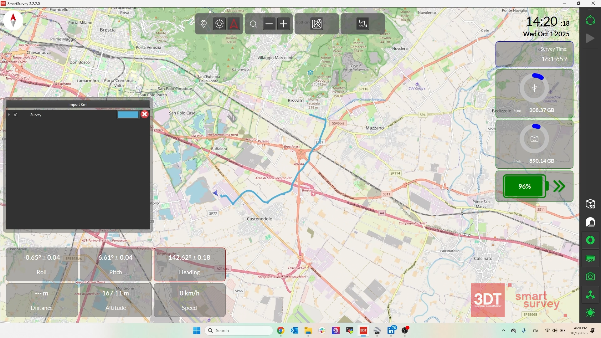
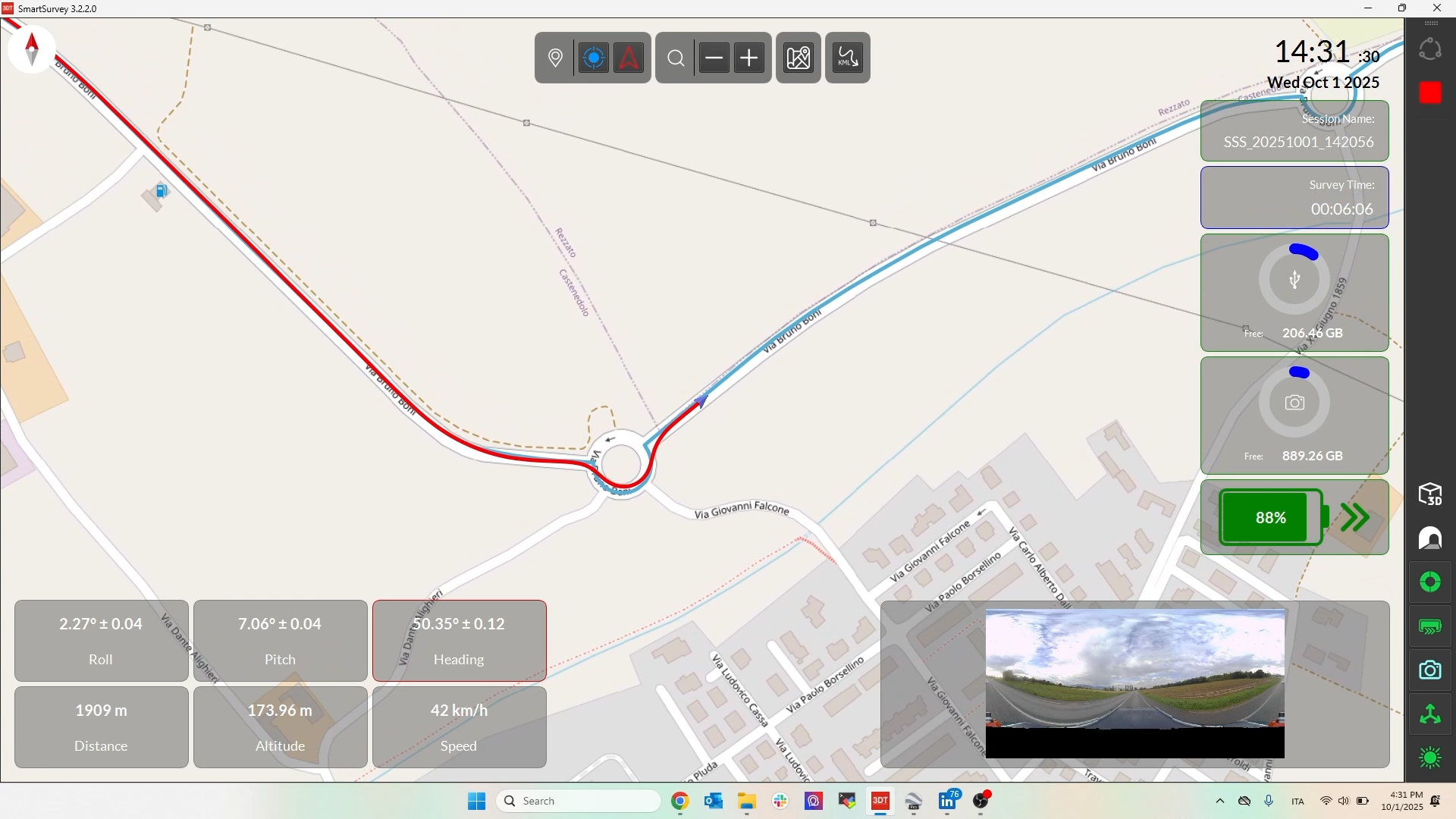
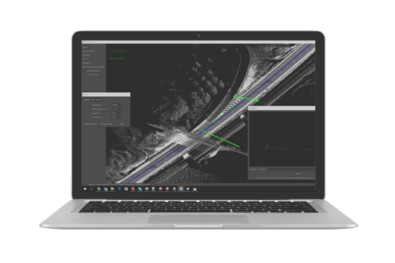
The Mission planning is simplified by importing KML files for the route and quickly configuring pre-acquisition parameters, data quality is ensured by the inspection of the Point Cloud in real-time and the verification of camera synchronization via full-screen preview.
SmartSurvey: the heart of control
Overview
SmartSurvey is optimized for Windows 11 and touchscreen and offers the best experience on tablets and portable devices.
The license is provided in the form of an activation file with detachable network seats.
SmartSurvey is much more than control software: it is the tool that makes every survey a smooth, aware, and reliable process.
Continuous Status Monitoring
- Sensor Health Dashboards
Continuous, granular feedback on the status of the INS, LiDAR, and Camera. - Mission Control Status
Dedicated icons signal the current session state, indicating when it can be armed, is actively recording, or is ready for final closure. - Critical Alerts
Storage and battery icons dynamically change color, providing essential low-resource warnings.
Mission Planning
- KML Import for Route Guidance
KML files allow operators to overlay planned routes directly onto the map as a reference track, to monitor coverage and paths directly during acquisition. - Pre-Acquisition Setup
A configuration window allows immediate verification and modification of INS, LiDAR, and Camera settings before starting the survey. - Dynamic View Controls
Center the map on the vehicle’s current location, adjust the orientation, and manage zoom functions during the mission.
Full control of every sensors
- Real-Time Point Cloud Inspection
The operator can toggle the georeferenced point cloud as the primary display, enabling instantaneous spatial checks.
- Visualization Enhancement
Shader application can be toggled to improve the definition of the edges and surfaces of the point cloud, helping your visual quality control.
- Camera Data Verification
The image preview provides immediate visual context and can be scaled to full screen for detailed camera synchronization and field of view inspection.
Related products

The dual lidar solution for 3D Lidar scanning. Perfect for Mobile Mapping applications. Recommended speed up to 100 Km/h.

Redefine mapping: anytime, anywhere with Scanfly PRO! THE MULTI-PLATFORM MAPPER

EVOlution - Map effortlessy with Scanfly EVO! THE MULTI-PLATFORM MAPPER
Advanced mobile mapping data analysis tool.
The software to produce your point clouds with just a few clicks.
The Scanfly integrated application software at your fingertips.