Italiano


Scanfly ULTRA
Increase the range and the resolution with a long-range mapping system
Powered by Velodyne ULTRA Puck
Applanix INS (IMU/GNSS)
Multi-constellation GNSS receiver (GPS/Glonass/Beidou/Galileo/
QZSS/SBAS/L-Band
Integrated board to control,
acquire and synchronize sensors
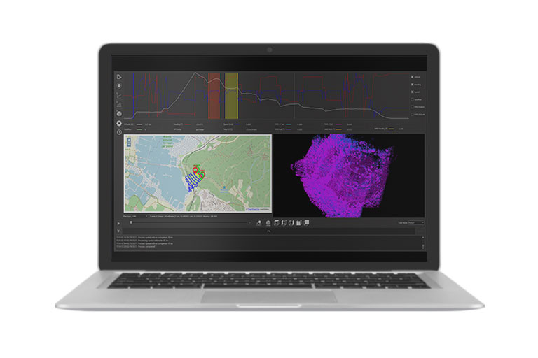
Software: SmartProcessing Lidar for data fusion
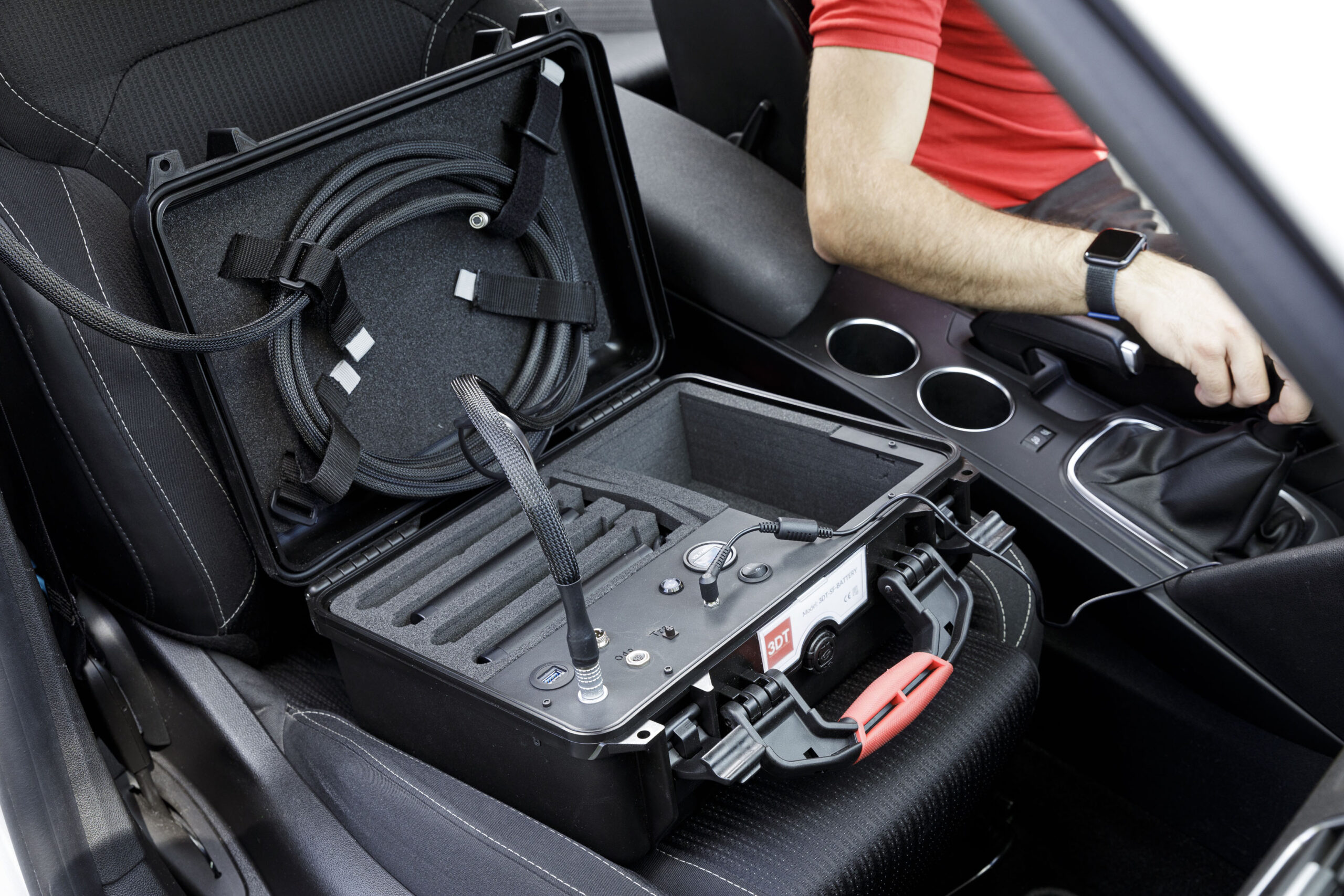
Carry case
Customized mounting interface
Easy installation on any vehicle
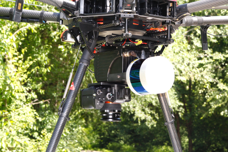
24-42 MP RGB camera
Multisensor integration interface
60.5 MP panoramic camera
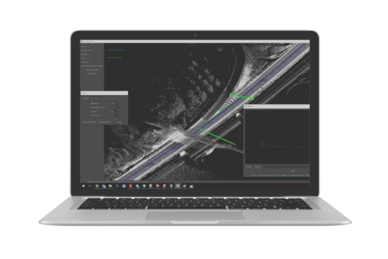
Boresight calibration tool
Ground control points and strip alignment tool
CE Marking
Ingress Protection IP55
Scanfly ULTRA
INCREASE RANGE AND DENSITY OF YOUR POINT CLOUDS
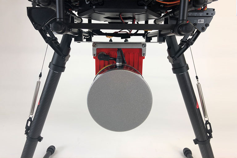
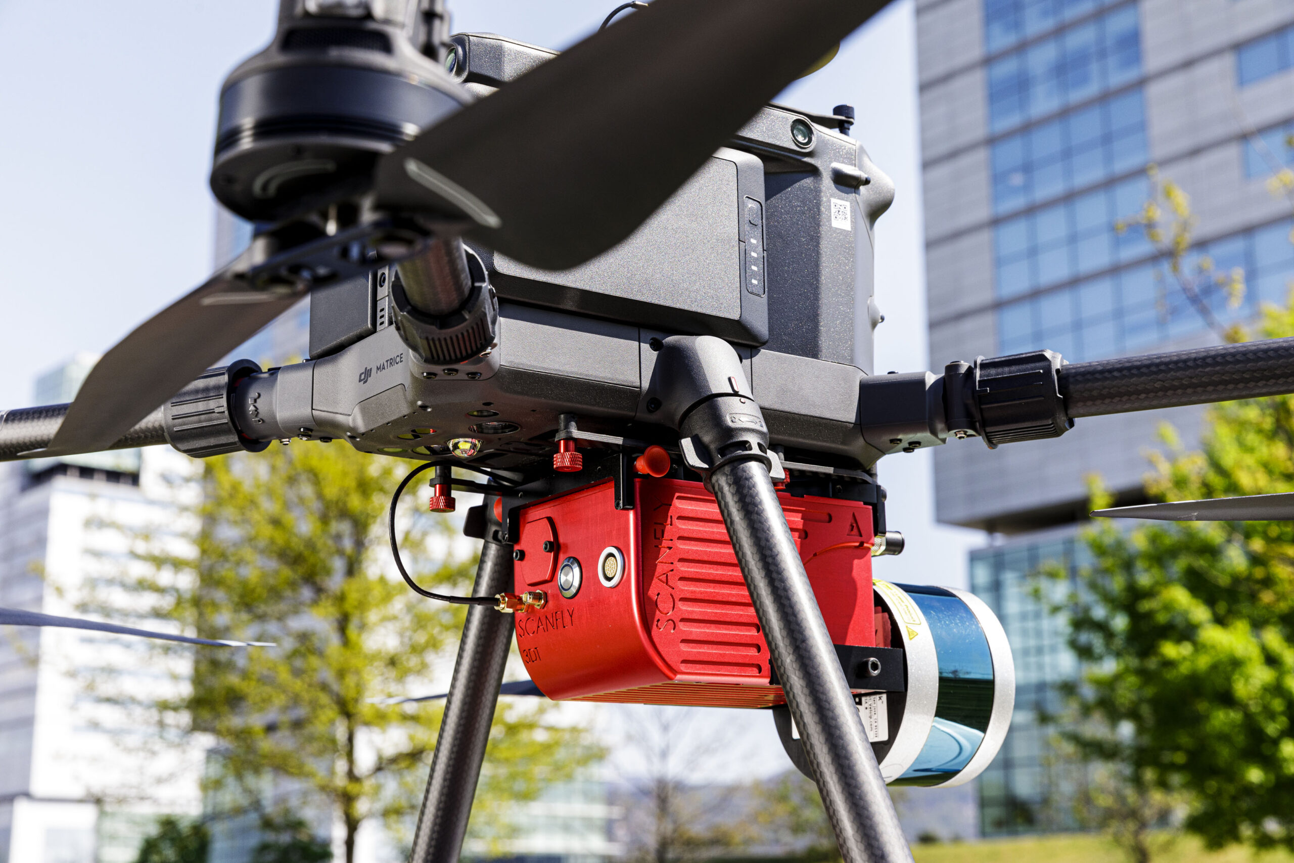
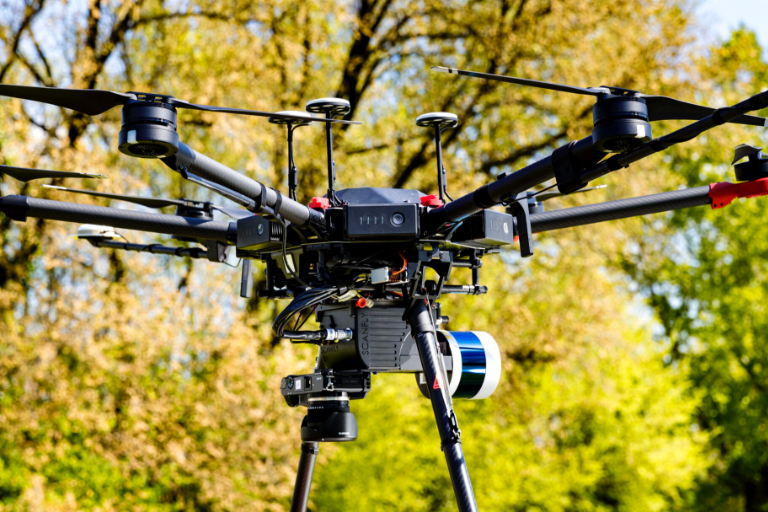
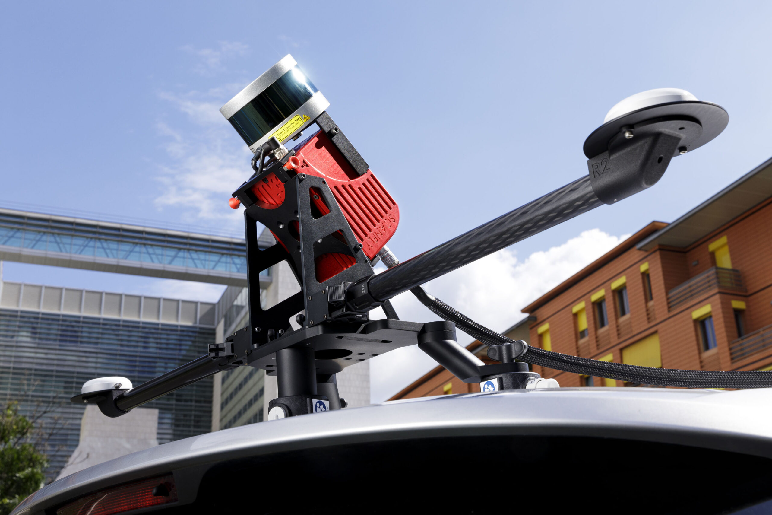
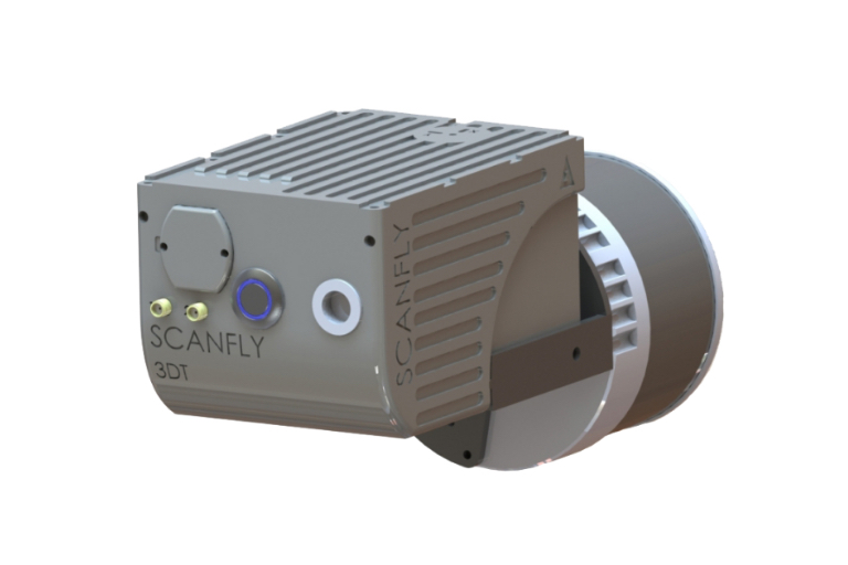
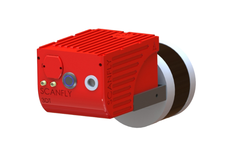
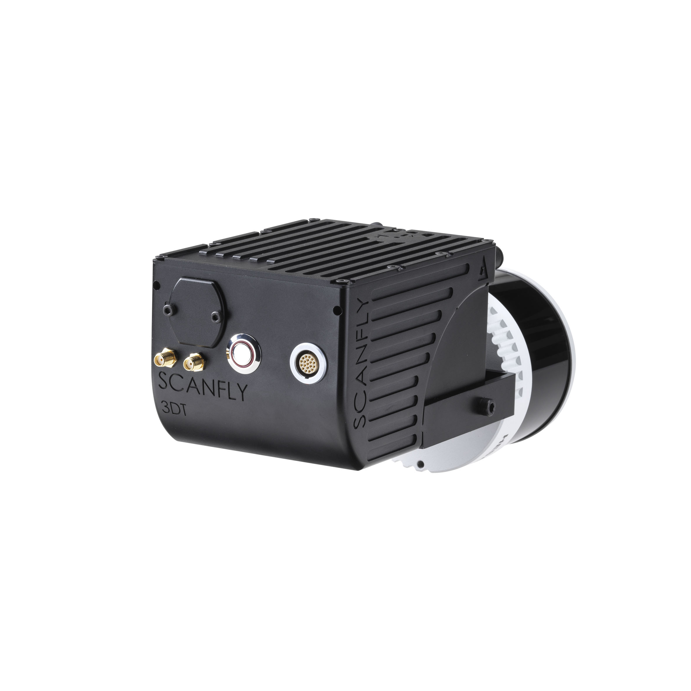
Scanfly ULTRA includes the VLP-32C Ultra Puck, the Velodyne’s long-range sensor designed to exceed the demands of the most challenging real-world 3D mobile mapping applications. Scanfly ULTRA weighs 1.95 kg and its 32-channel sensor has a range of up to 200 meters. The sensor keeps the same features of all Scanfly family while generating up to 1 200 000 measurements per second in dual return mode.
The payload lidar not only for UAS
Technologies
- Velodyne ULTRA Puck Lidar
- Applanix APX-15L INS
Lidar integration
- Multirotor drone
- Helicopter drone
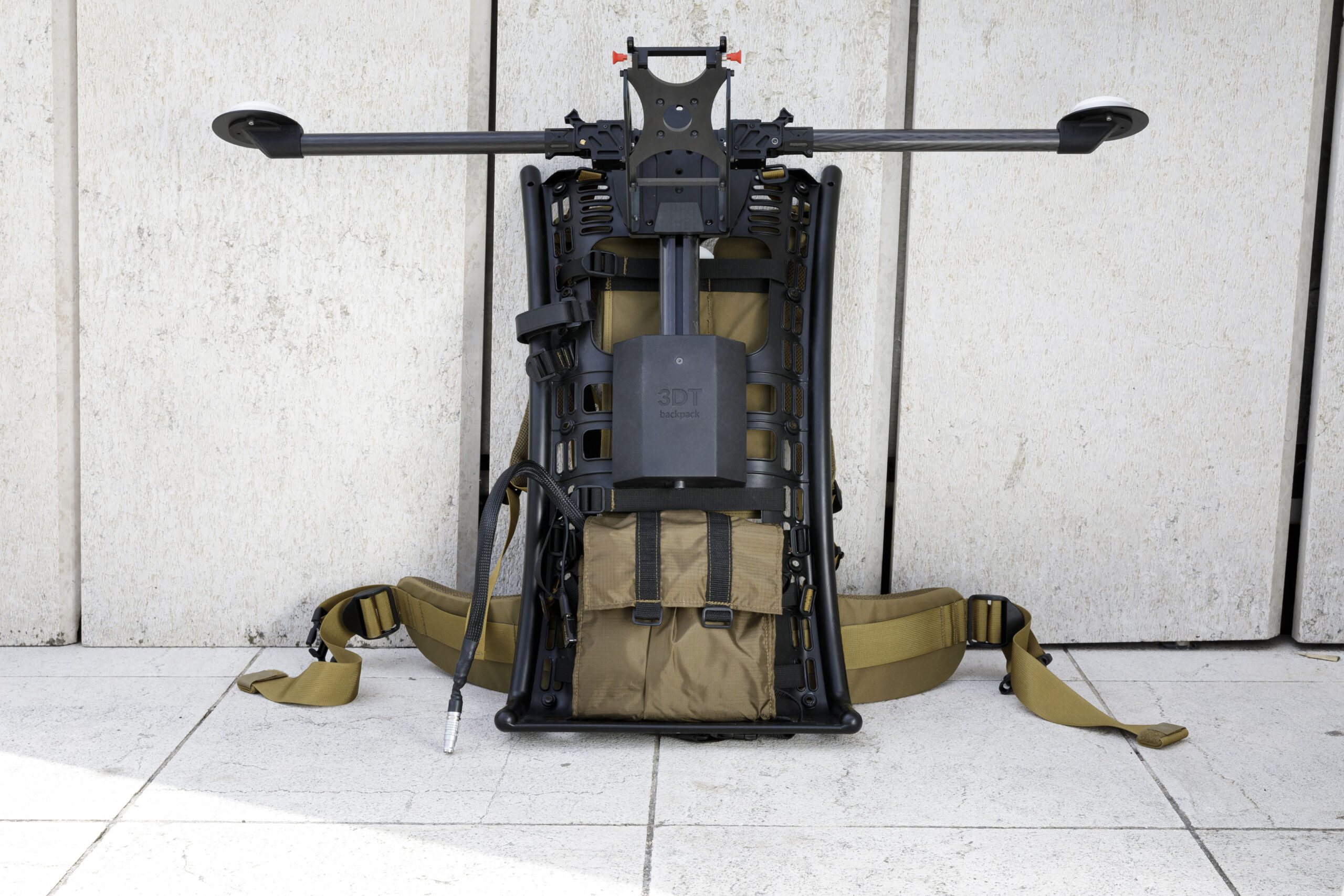
- Backpack mount
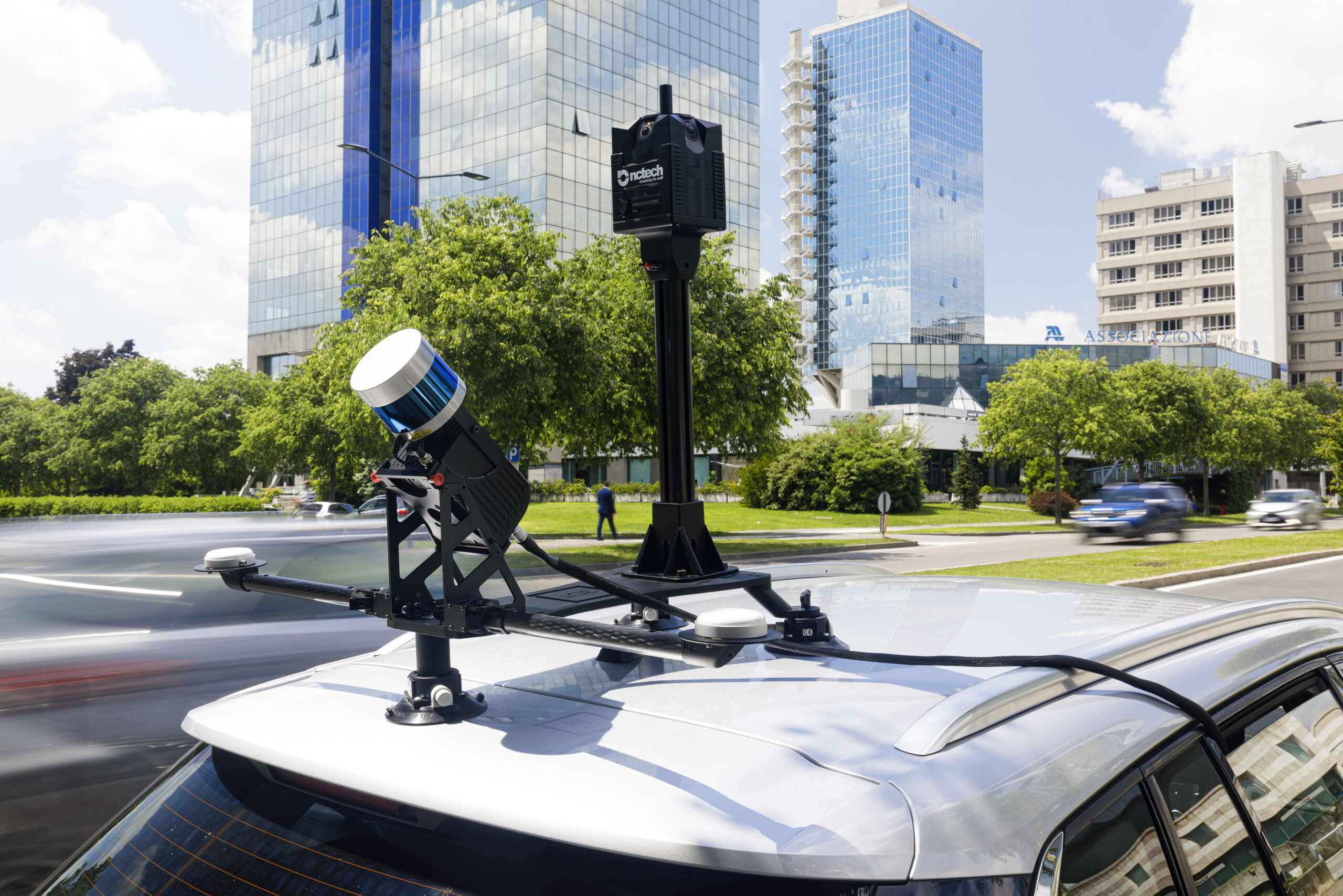
- Car mount
Key features
- 200 m range
- High resolution
- Calibrated reflectivity
- Dual return
Technical details
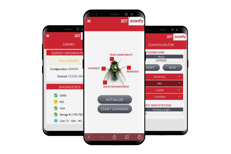
Code 3DT-SF-v2-ULTRAa Lidar Head Velodyne Ultra Puck Weight 1.79 kg Dimensions 250 x 131 x 108 mm Ingress Protection IP 55 (CE) Scan Rate Up to 1 200 000 pts/sec Range up to 200 m Point Cloud Accuracy 5 cm Precision 10 cm Storage Internal 512 GB, Upgradable to 1 TB Connection Ethernet, Wi-Fi Software Scanfly Web App, SmartProcessing Lidar, SmartSurvey Scanfly (optional)
Product dimensions

In the box
Hardware
- Scanfly ULTRA
- Multi-pin cable
- Quick release mount
- Wi-Fi Tranceiver
- Ethernet adapter
- USB flash drive